Source and permitted use
Selected maps from Dr. Michael Izady’s Atlas of the Islamic World and Vicinity, hosted by Columbia University’s Gulf/2000 project. Original catalogue.
The catalogue permits personal use with attribution to Dr. Izady as author and Gulf/2000 as host. Copyright remains with the author. Public reposting, publication, and commercial use require the author’s permission. Saved images preserve their original legends, commentary, source lists, and watermarks.
How to read the maps
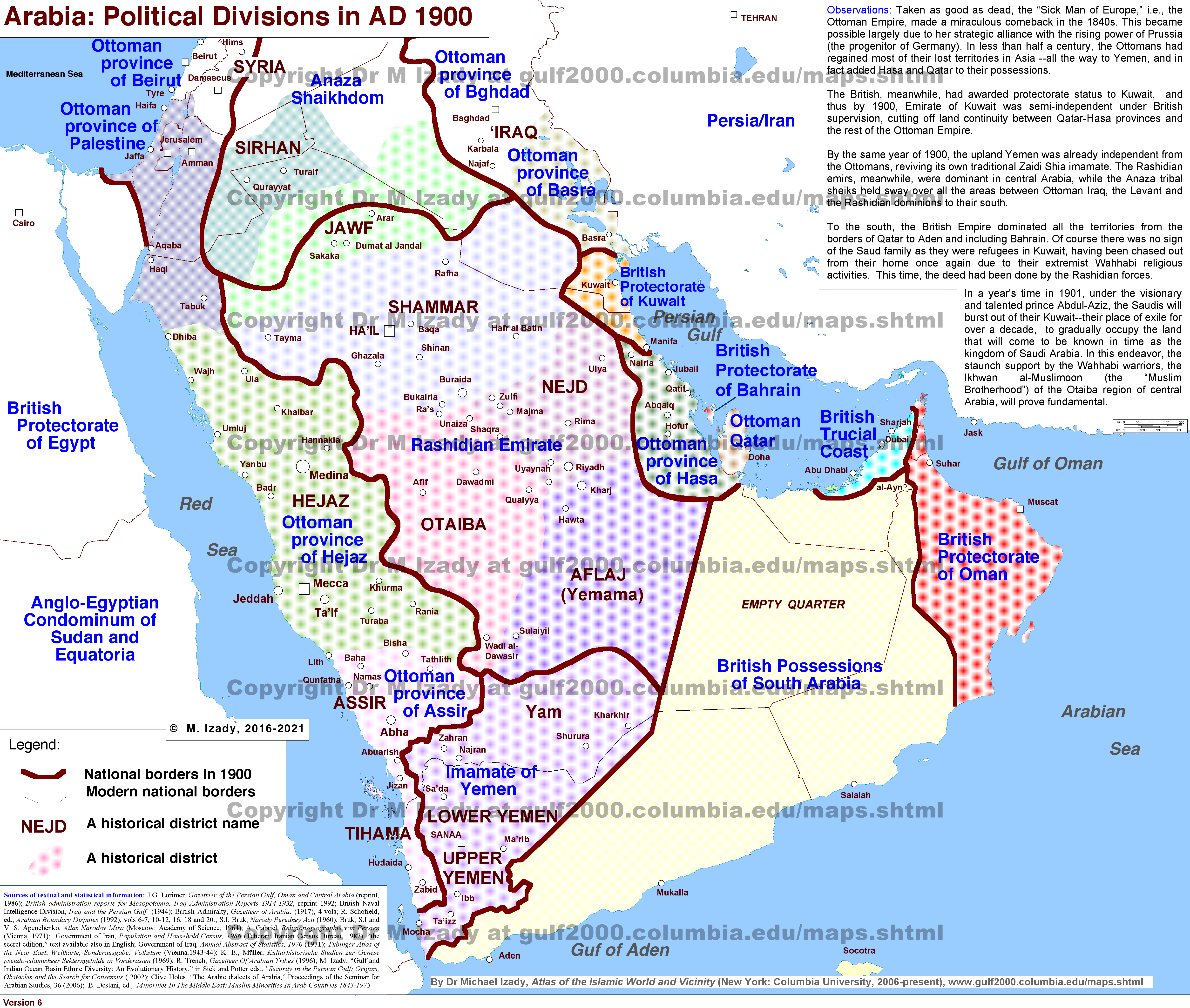
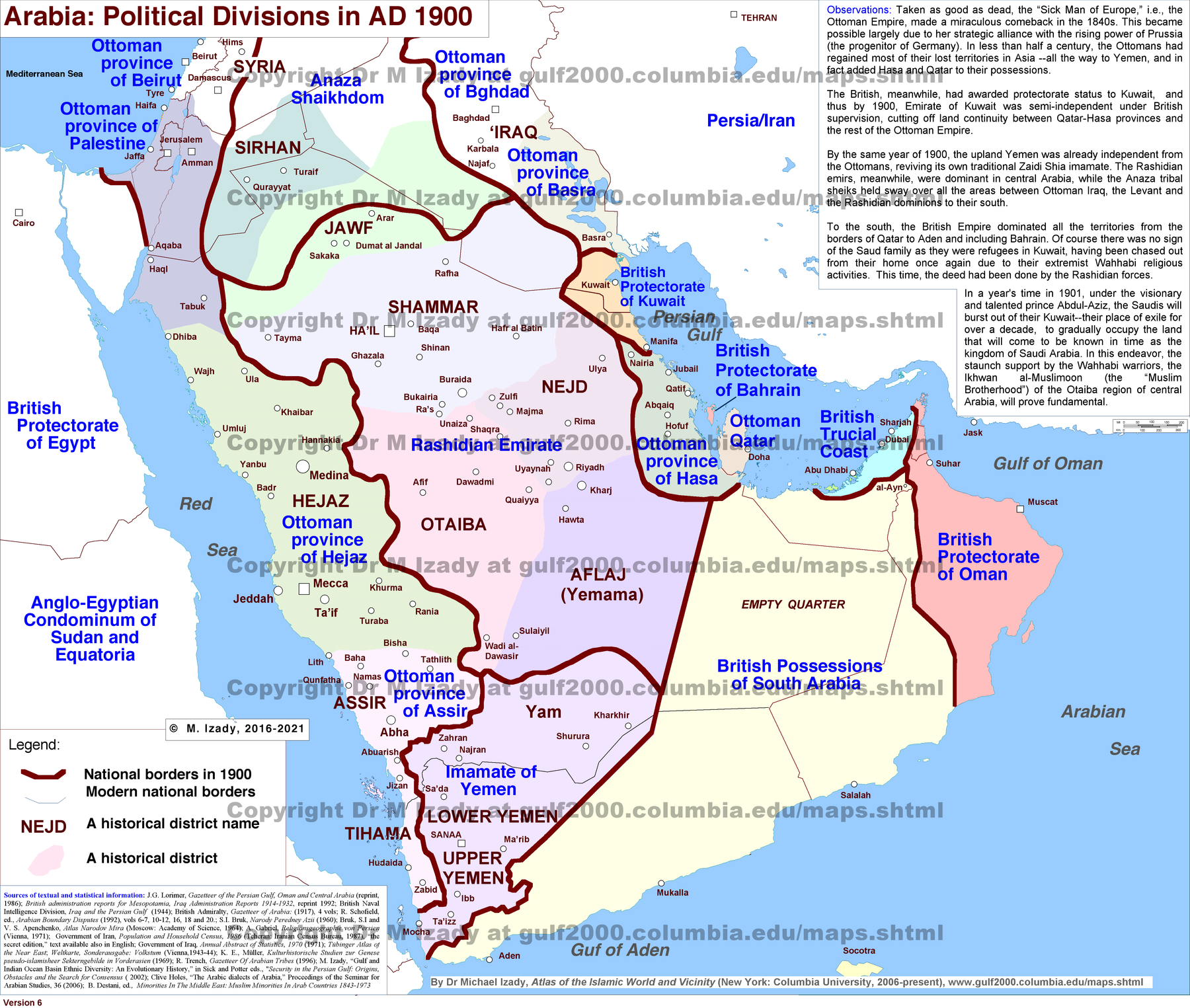
- Historical reconstruction: a circa-1900 map was made later to depict that period; it is not necessarily an atlas printed in 1900.
- Control and sovereignty: distinguish formal sovereignty, occupation, protectorate arrangements, and direct colonial administration. Egypt in 1900 was British-occupied and nominally Ottoman; its formal British protectorate began in 1914.
- Dates: read the date of the geography separately from the image’s publication or revision date. A 2010, 2014, or mid-2024 map is not current to 2026.
- Demographic estimates: settlement colors, estimates, and group boundaries represent the author’s synthesis. They are not a unified census, exact borders between homogeneous populations, or maps of political allegiance.
- Classification: ethnicity, language, religion, and nationality are different dimensions. Izady’s religious categories, particularly some groupings of Alawites, Yazidis, and other traditions, are interpretive rather than a universal theological consensus.
- Causation: comparing two maps does not itself establish responsibility for displacement, demonstrate genocide, or explain a conflict. Keep the source’s commentary separate from independently established findings.
- Predictions and proposals: hypothetical federal arrangements and future “crescent” maps were not selected as maps of actual political conditions.
Where the selected maps belong
- 60 Knowledge/Countries/Middle East: 5 embedded map(s).
- 60 Knowledge/Countries/Ottoman Caliphate: 1 embedded map(s).
- 60 Knowledge/Countries/Saudi Arabia: 3 embedded map(s).
- 60 Knowledge/60.11 Religion/60.11.1 Islam/Islamic Sects: 2 embedded map(s).
- 60 Knowledge/60.11 Religion/60.11.1 Islam/History of Islam: 2 embedded map(s).
- 60 Knowledge/Countries/Kurds: 1 embedded map(s).
- 60 Knowledge/Countries/Iran/Iran: 3 embedded map(s).
- 60 Knowledge/Countries/Lebanon: 2 embedded map(s).
- 60 Knowledge/60.1 Israel-Palestine/60.1.4 Main/Lebanon, Israel & Hezbollah - A Century of Conflict (1920-2026): 1 embedded map(s).
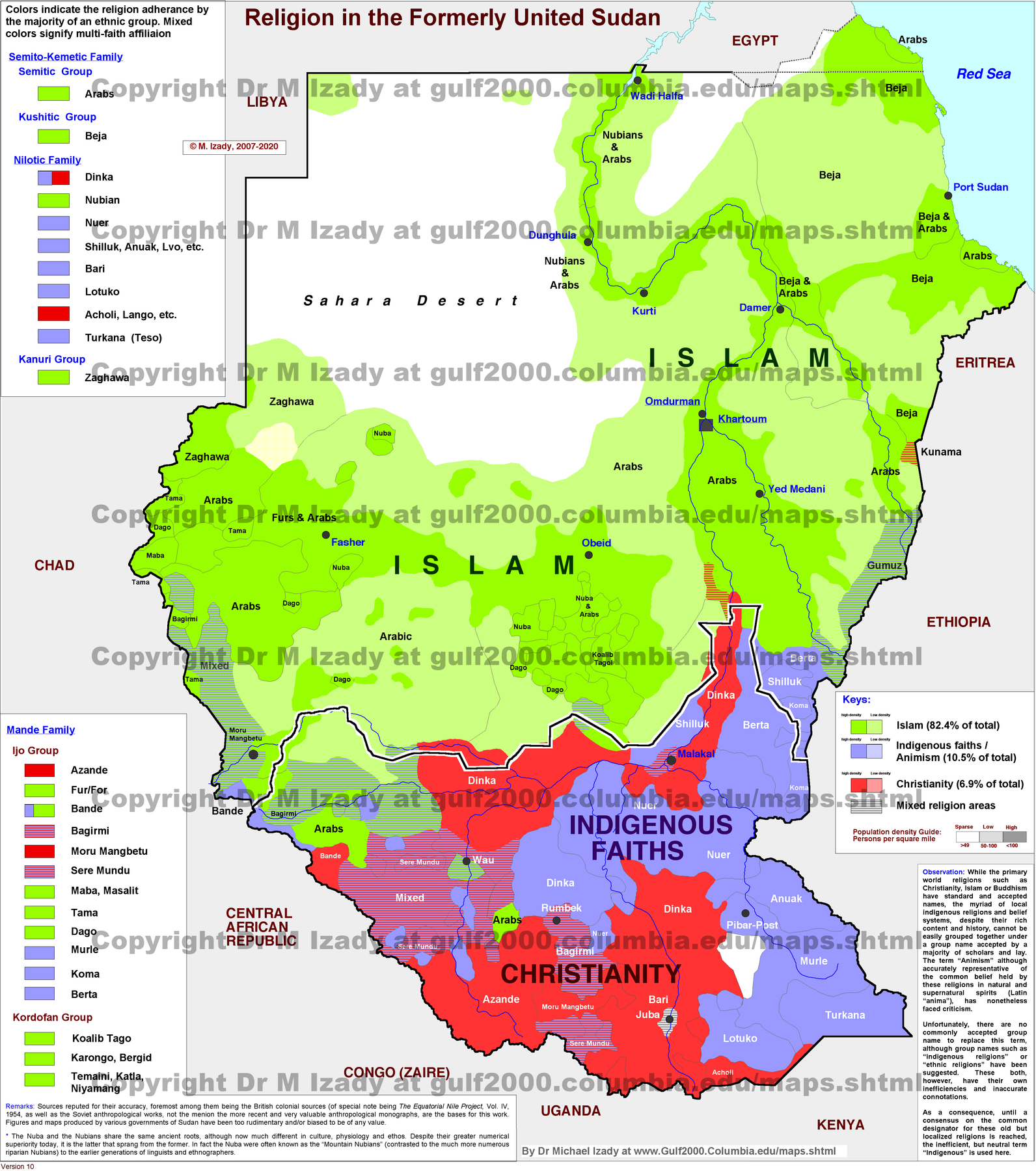
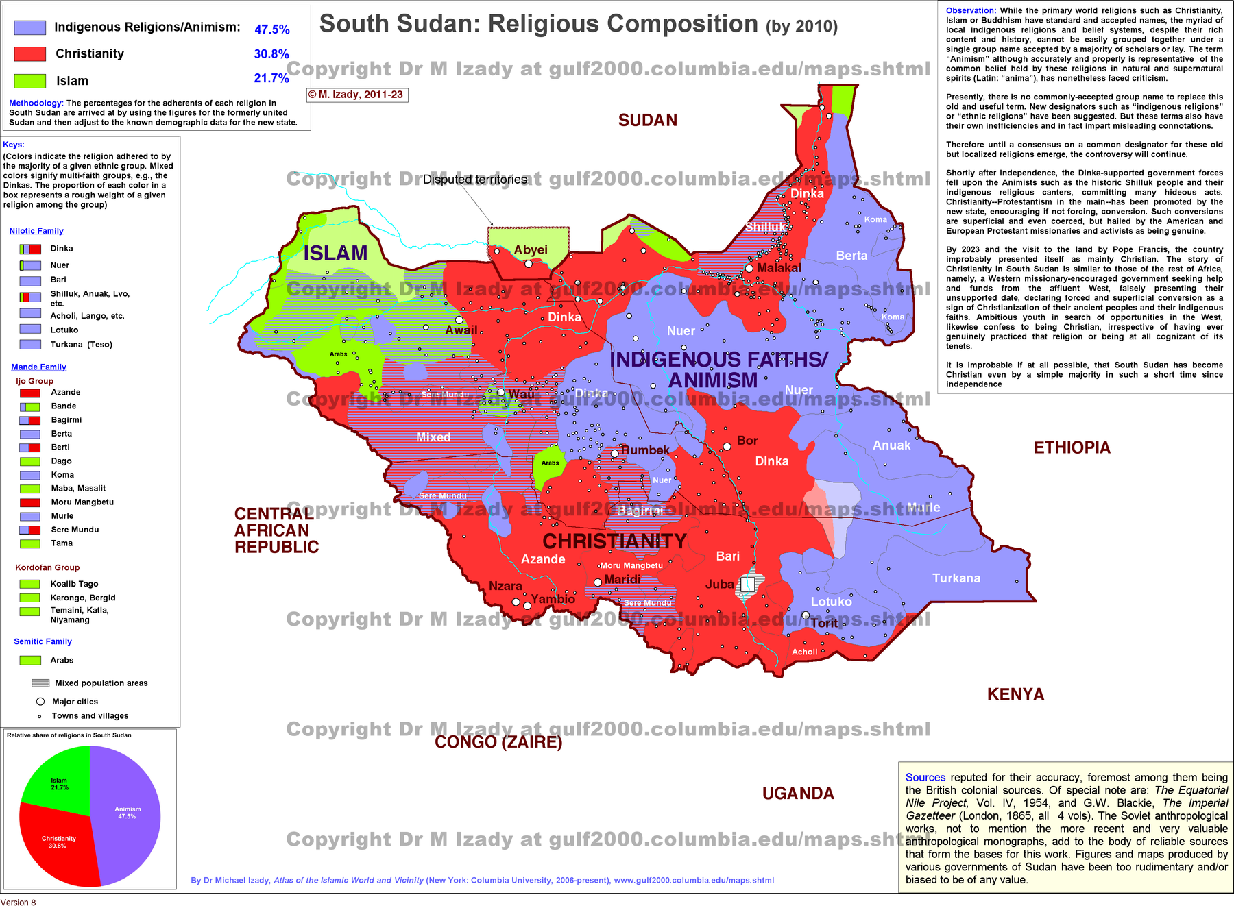
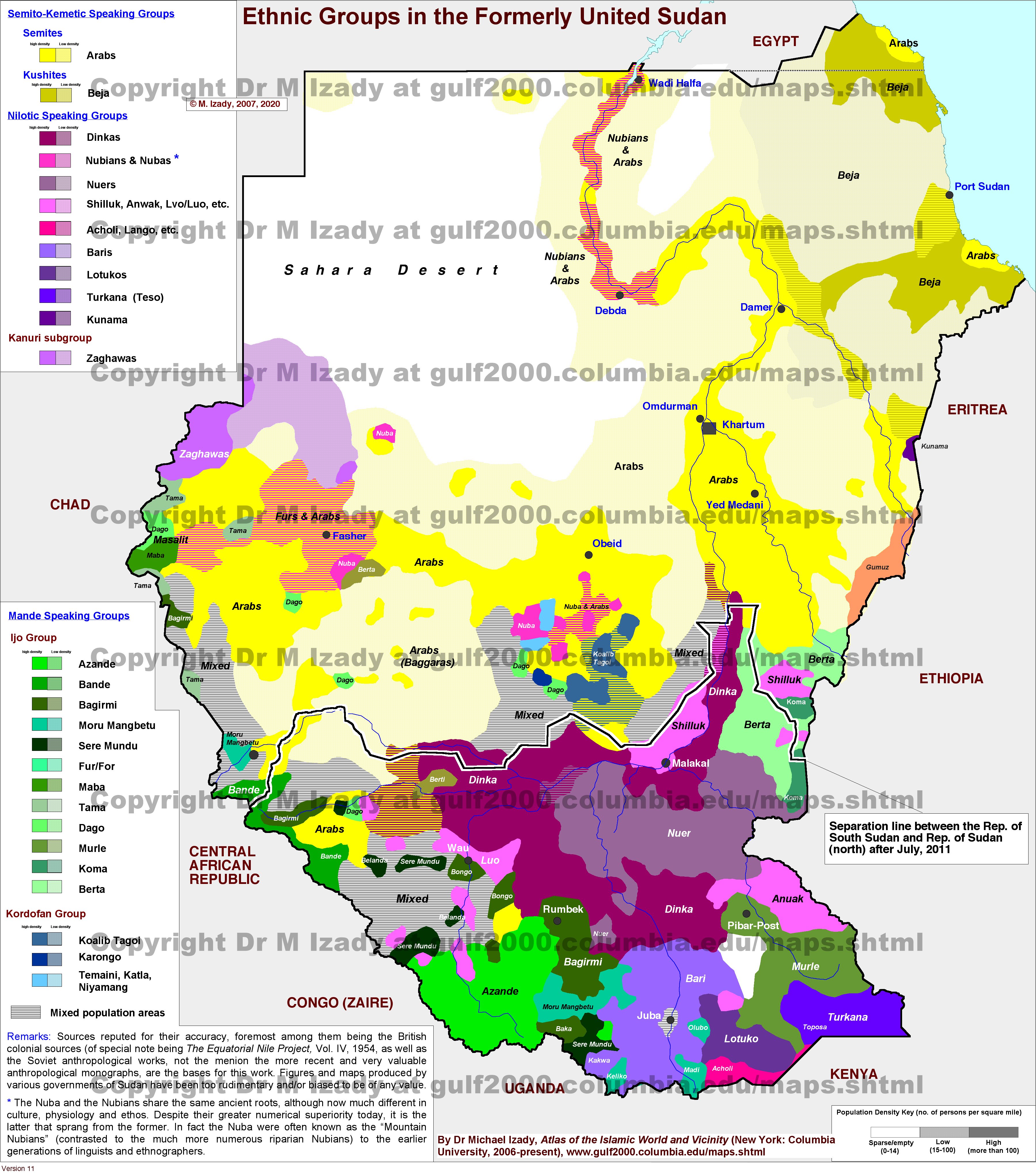
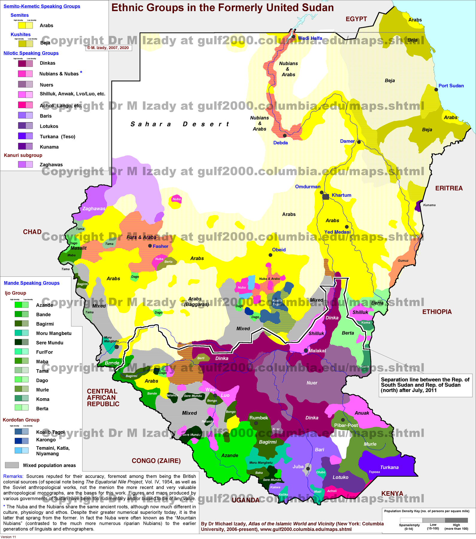
- 60 Knowledge/Countries/Sudan: 3 embedded map(s).
- 60 Knowledge/60.13 Wars/The First and Second Sudanese Civil Wars: 2 embedded map(s).
- 60 Knowledge/60.13 Wars/Iraq War/Iraq War: 2 embedded map(s).
- 60 Knowledge/60.1 Israel-Palestine/60.1.2 Misc/Christians in and around Israel: 2 embedded map(s).
- 60 Knowledge/60.1 Israel-Palestine/60.1.2 Misc/True History of the Middle East - Simon Sebag Montefiore: 2 embedded map(s).
- 60 Knowledge/Countries/Qatar/Qatar: 1 embedded map(s).
- 60 Knowledge/60.1 Israel-Palestine/60.1.4 Main/Iran & the Axis of Resistance: 2 embedded map(s).
- 60 Knowledge/Countries/Yemen: 2 embedded map(s).
Saved originals
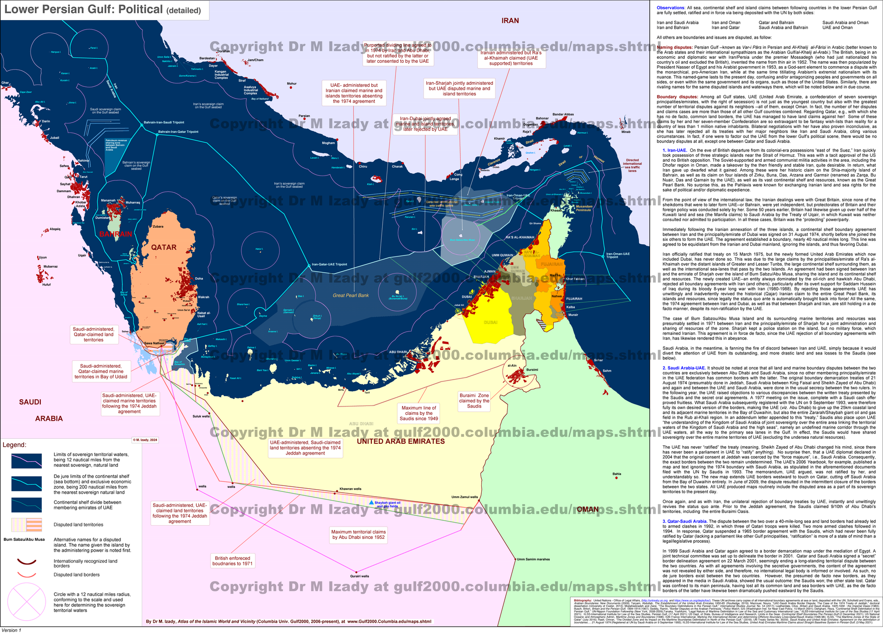
- Lower Persian Gulf, Political (detailed) · Saved original.
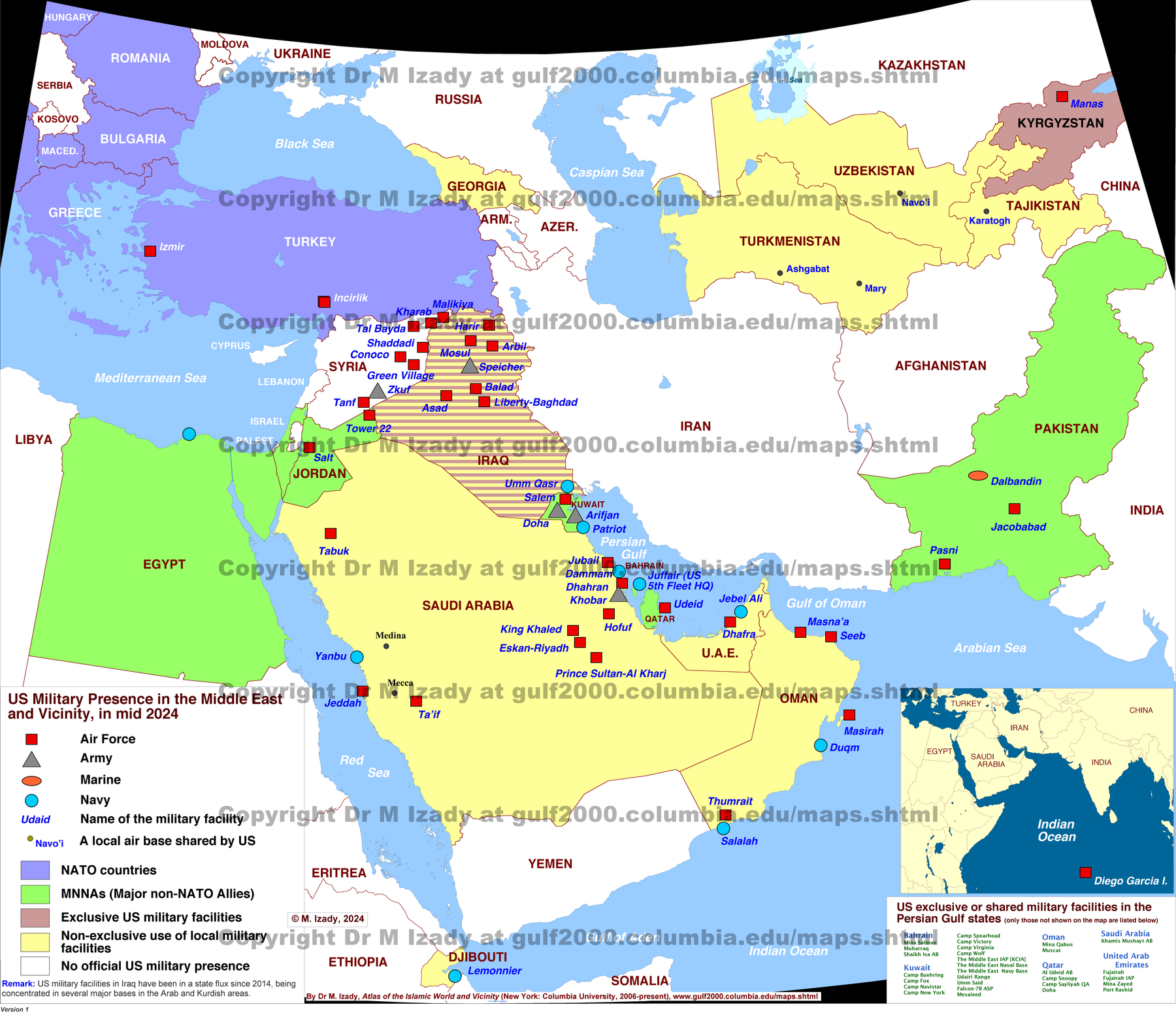
- US Military Bases and Facilities in the Middle East and Vicinity, mid. 2024 · Saved original.
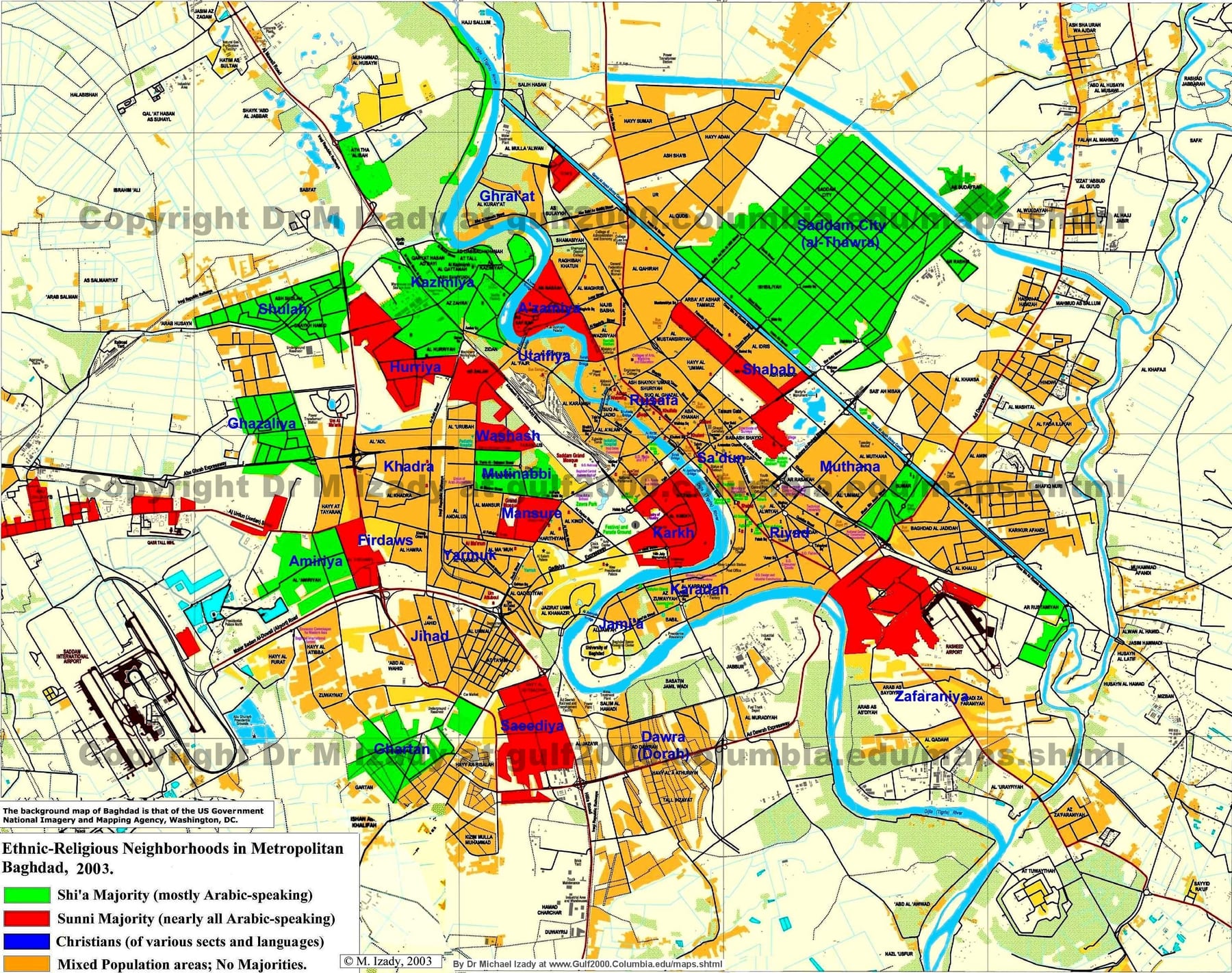
- Baghdad, Iraq, Ethnic composition in 2003 · Saved original.
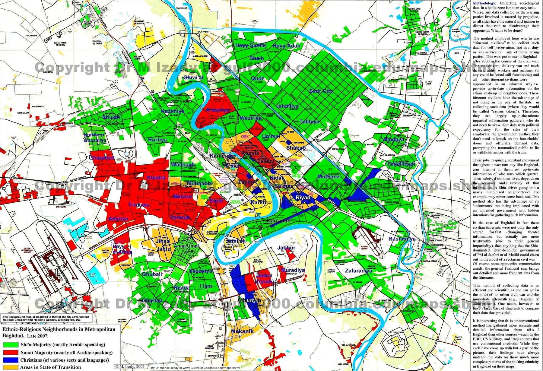
- Baghdad, Iraq, Ethnic composition in late 2007 · Saved original.
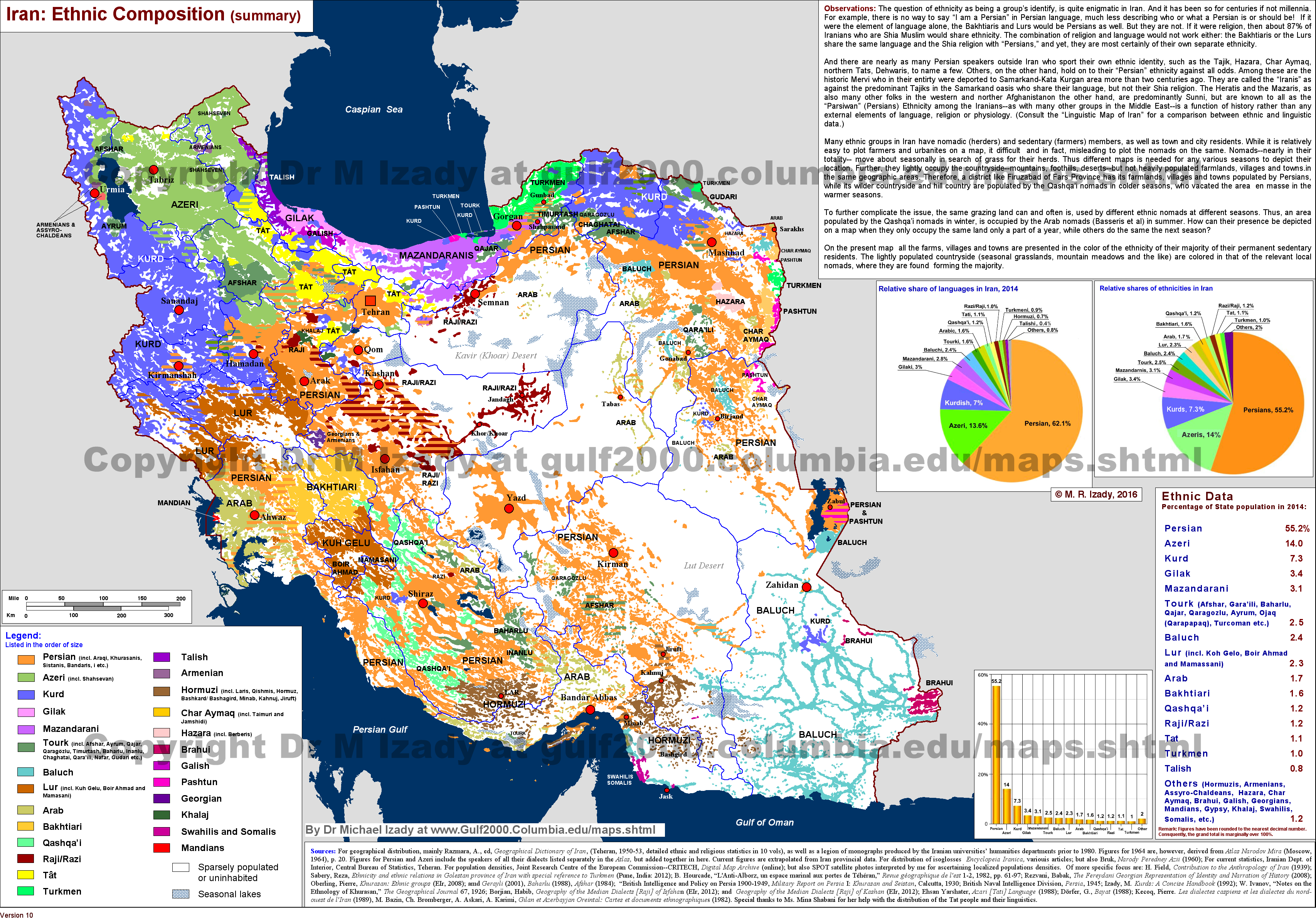
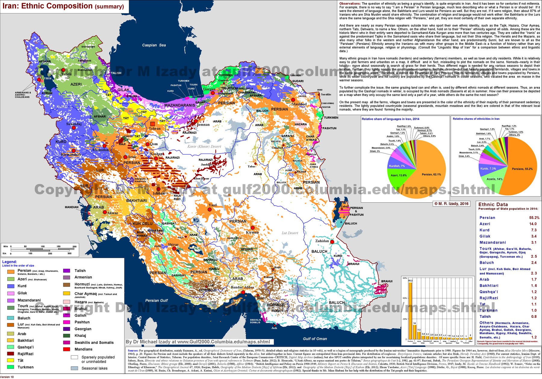
- Iran, Ethnic Composition (summary) · Saved original.
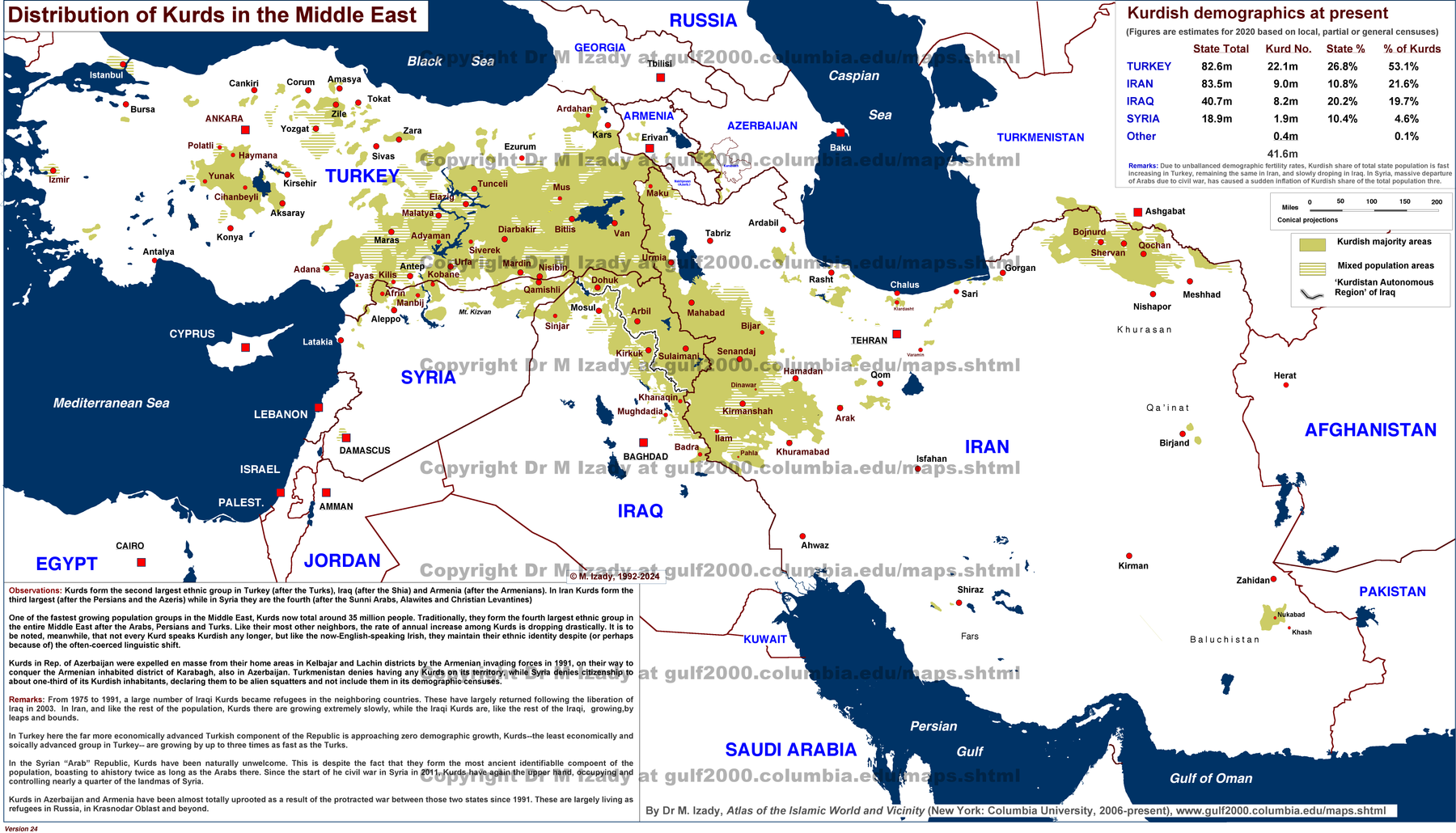
- Kurds in the Middle East and Vicinity · Saved original.
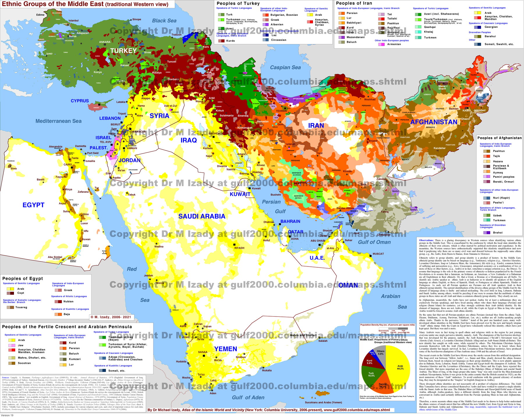
- Middle East, Ethnic Groups · Saved original.
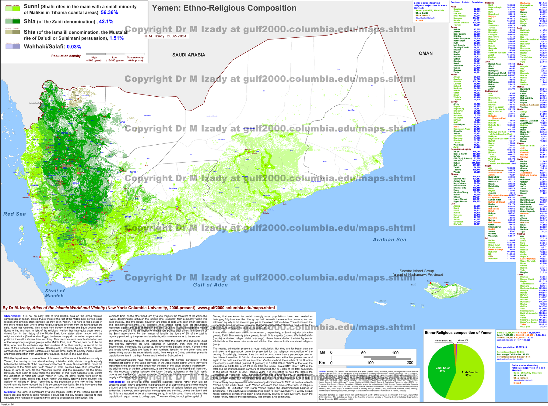
- Yemen, Ethnic and Religious Composition (detailed) · Saved original.
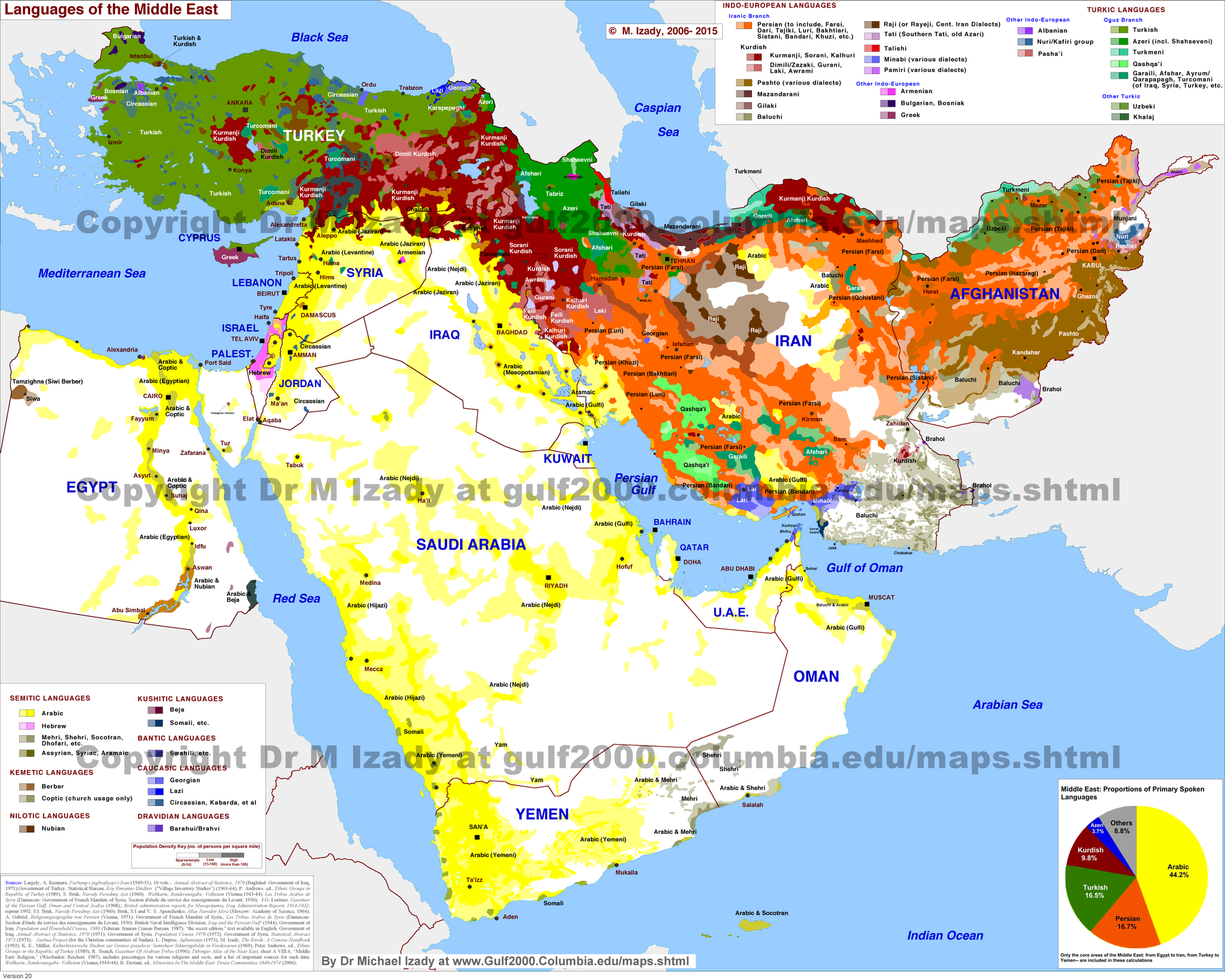
- Middle East, Languages · Saved original.
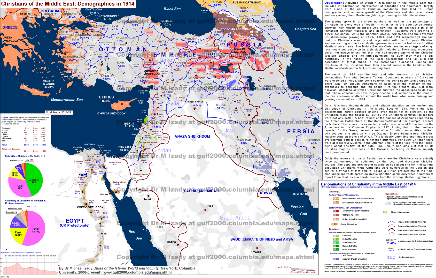
- Christian Population of Middle East in 1914 · Saved original.
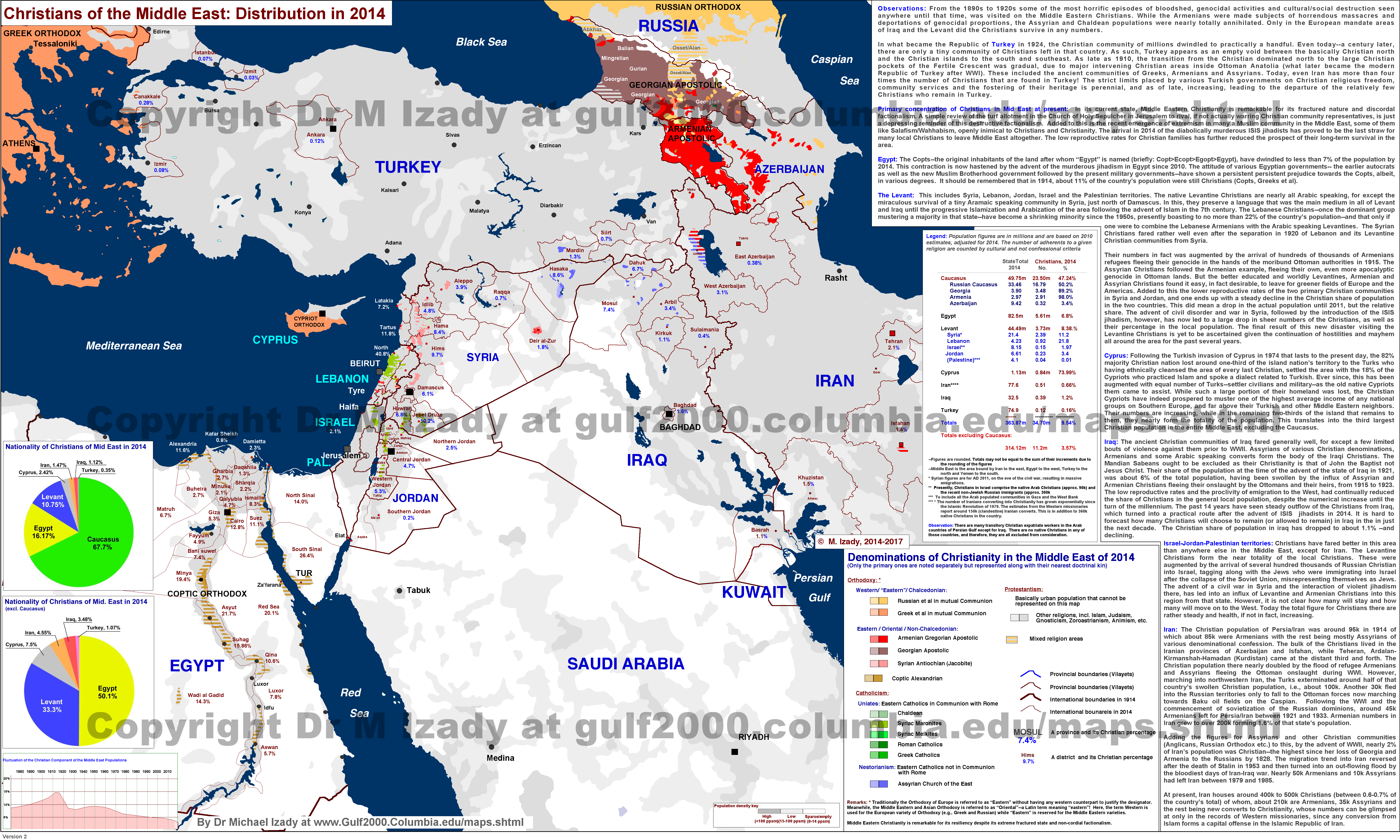
- Christian Population of Middle East in 2014 · Saved original.
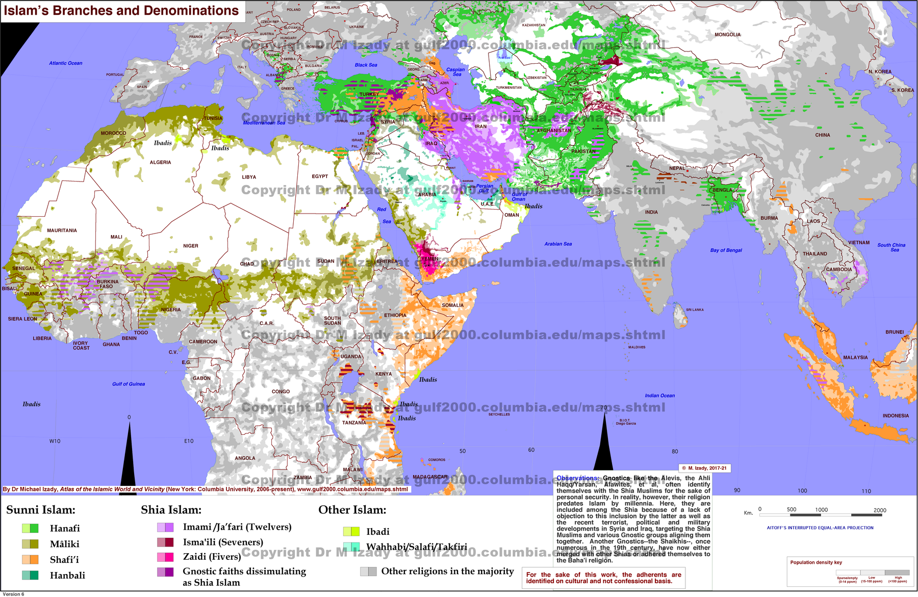
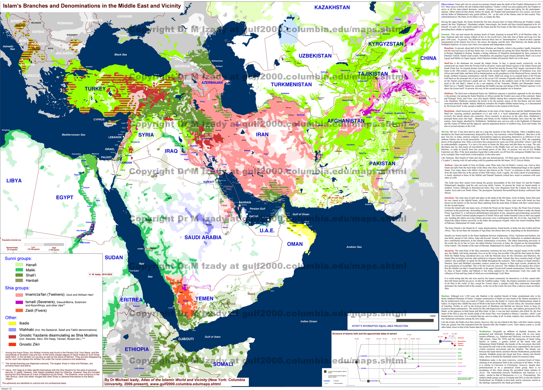
- Islam Branches and Denominations · Saved original.
- Islam’s Branches and Denominations in the Middle East · Saved original.
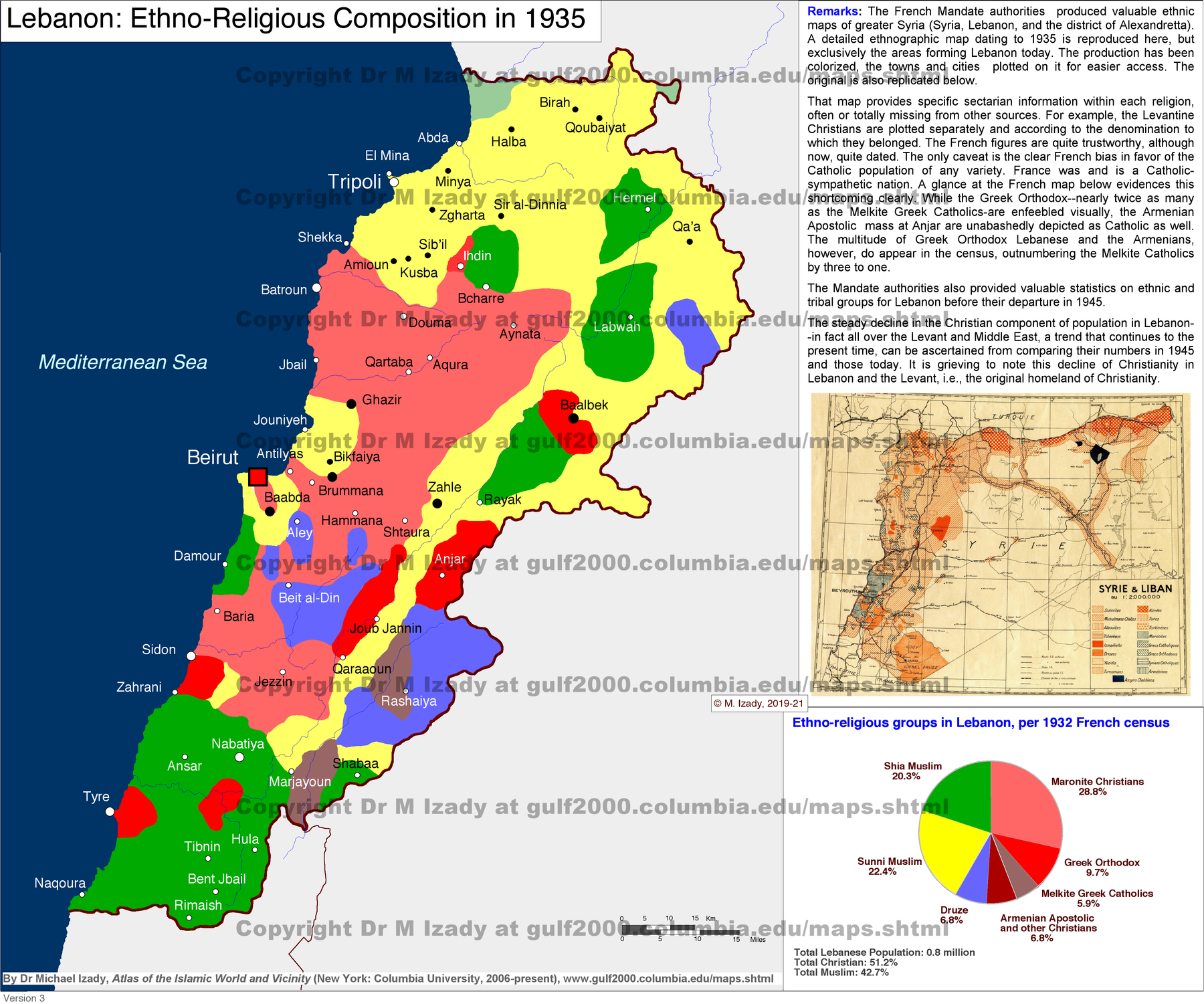
- Lebanon, Ethno-Religious Composition in 1935 · Saved original.
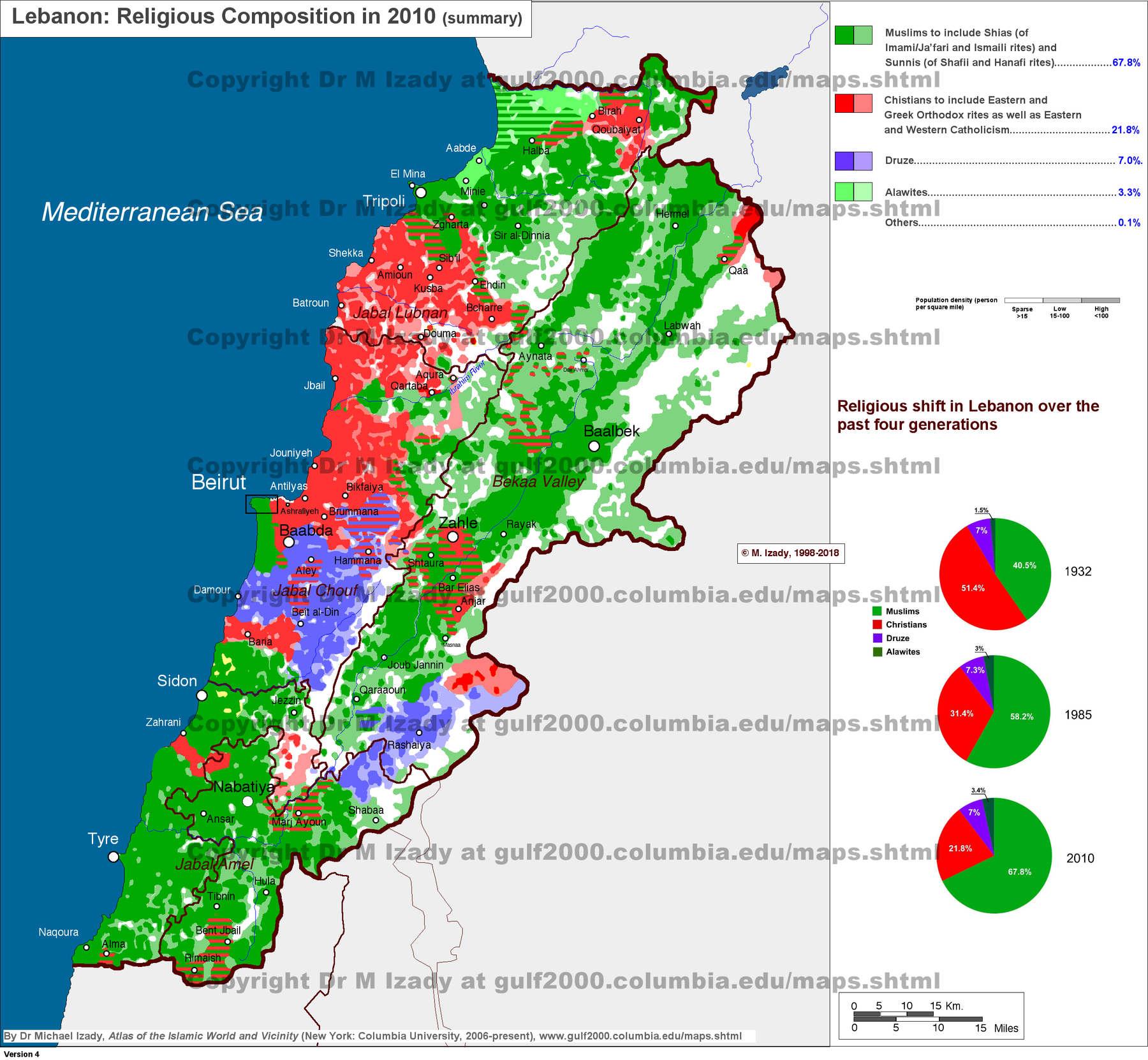
- Lebanon Religious Composition (summary) · Saved original.
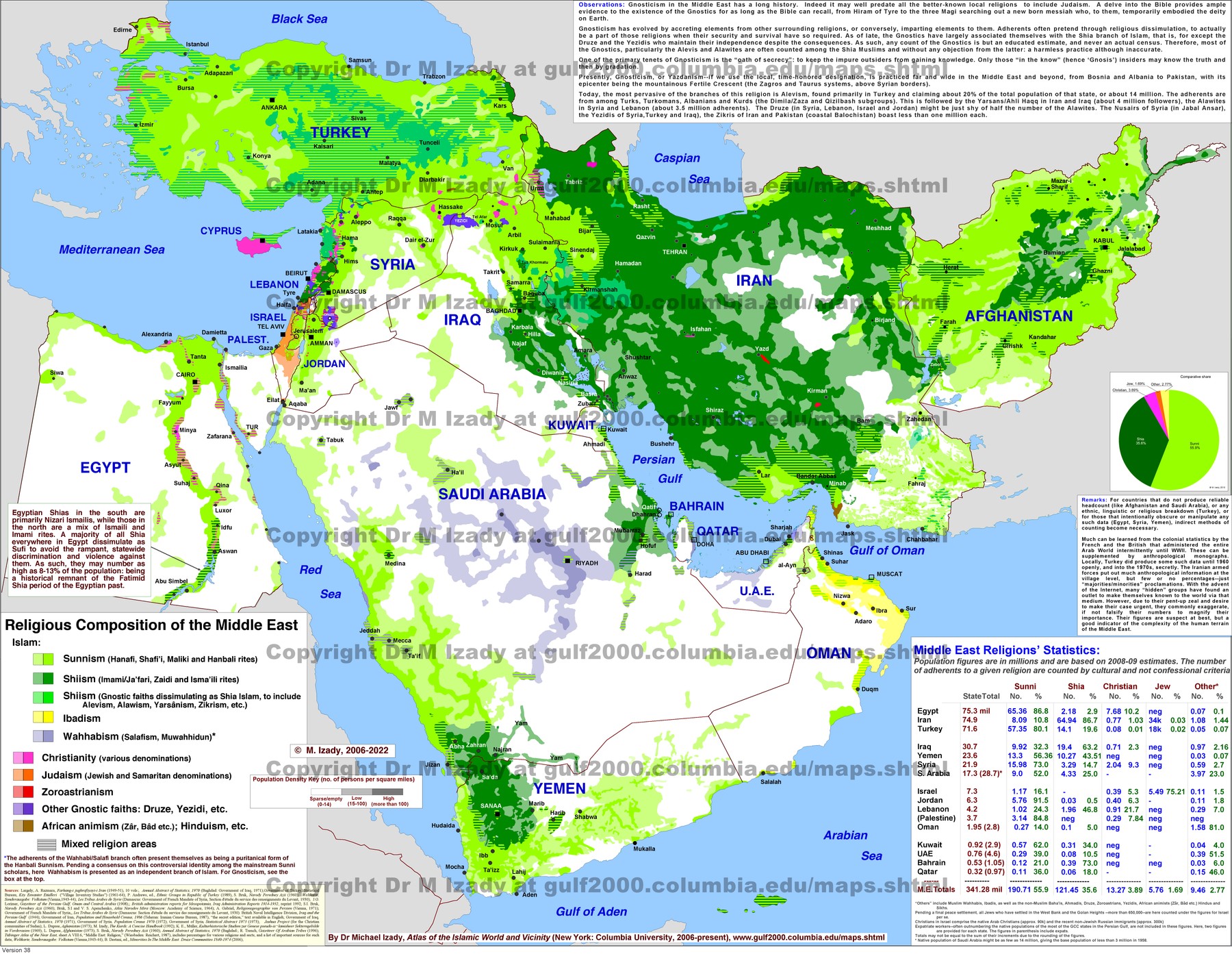
- Middle East Religions · Saved original.
- Sudan (formerly united) Religious Composition · Saved original.
- South Sudan Religions · Saved original.
- Sudan (formerly united), Ethnic Subdivisions · Saved original.
- Arabia: Political Divisions in AD 1900 · Saved original.
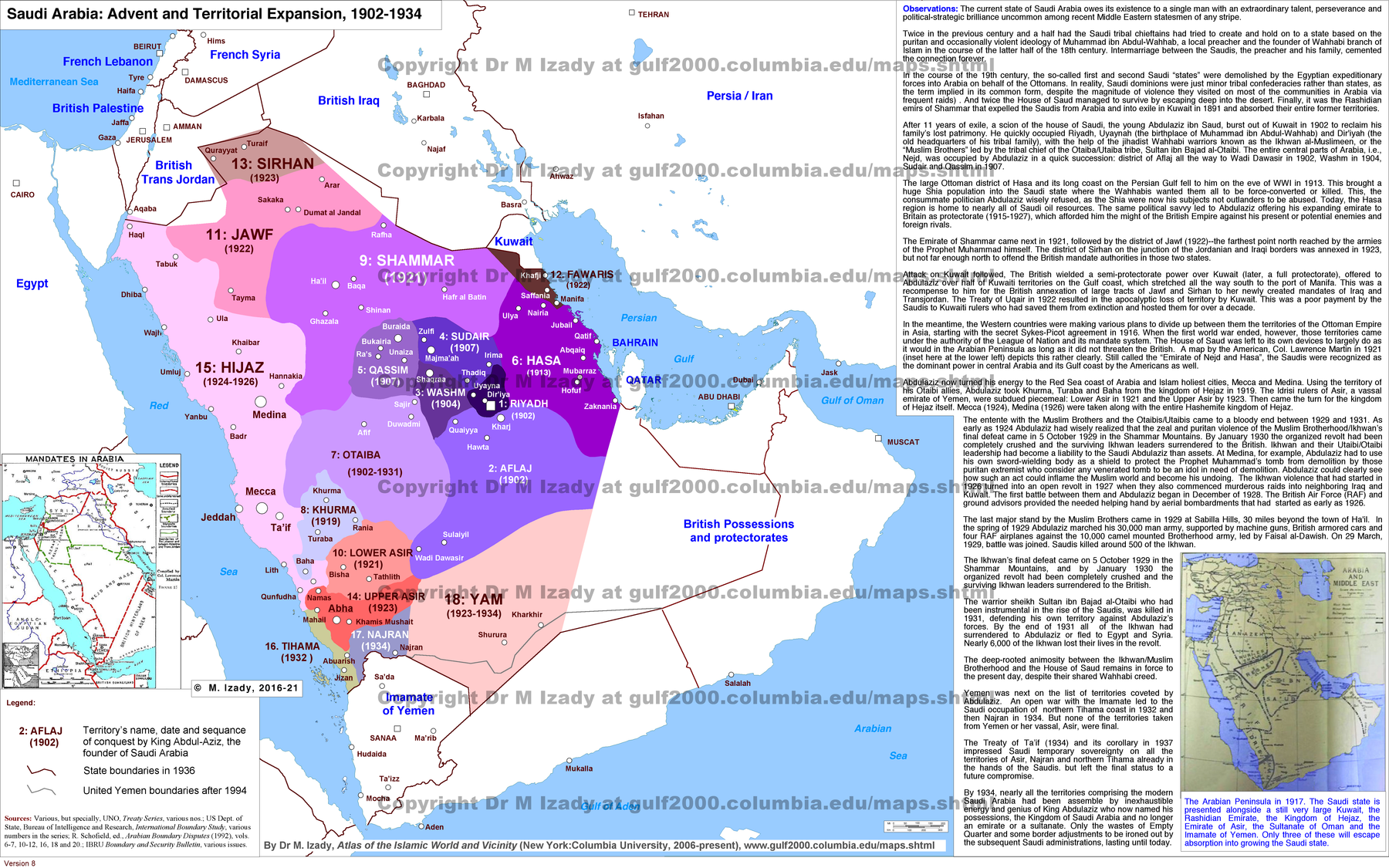
- Saudi Arabia, Advent and Territorial Expansion: 1902-1934 · Saved original.
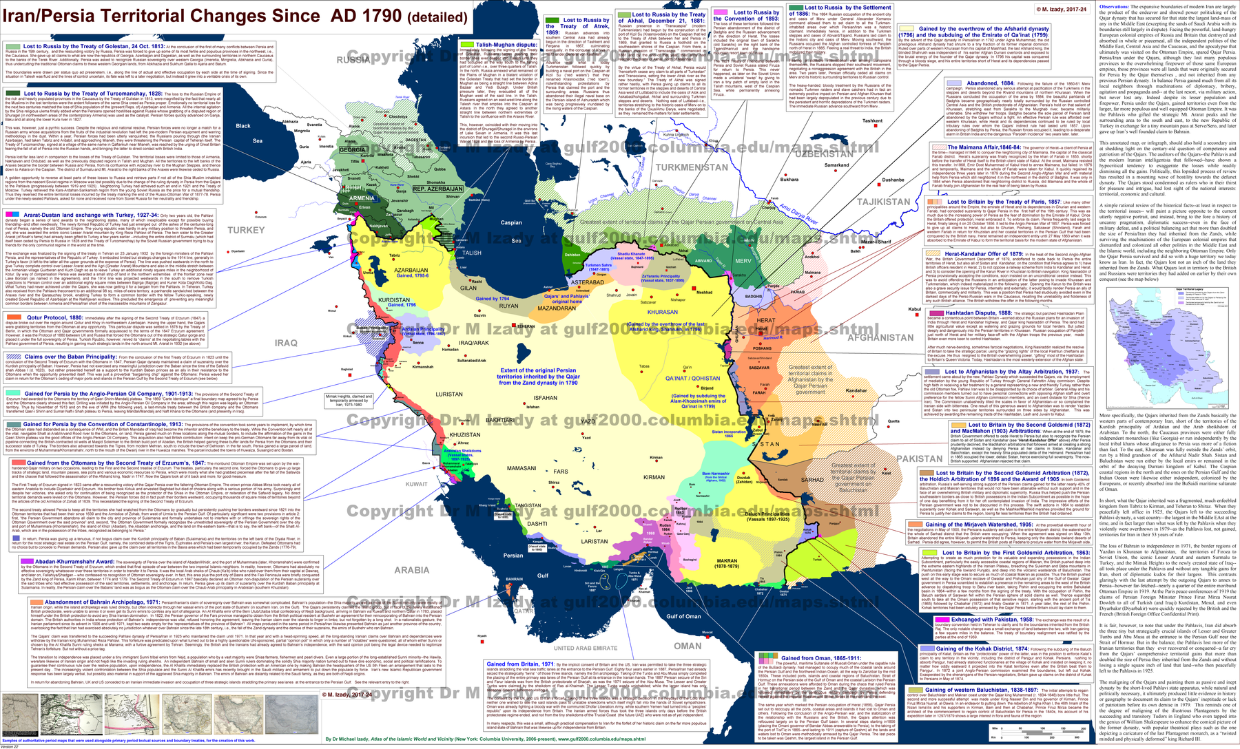
- Iran Territorial Changes since 1790s (detailed) · Saved original.
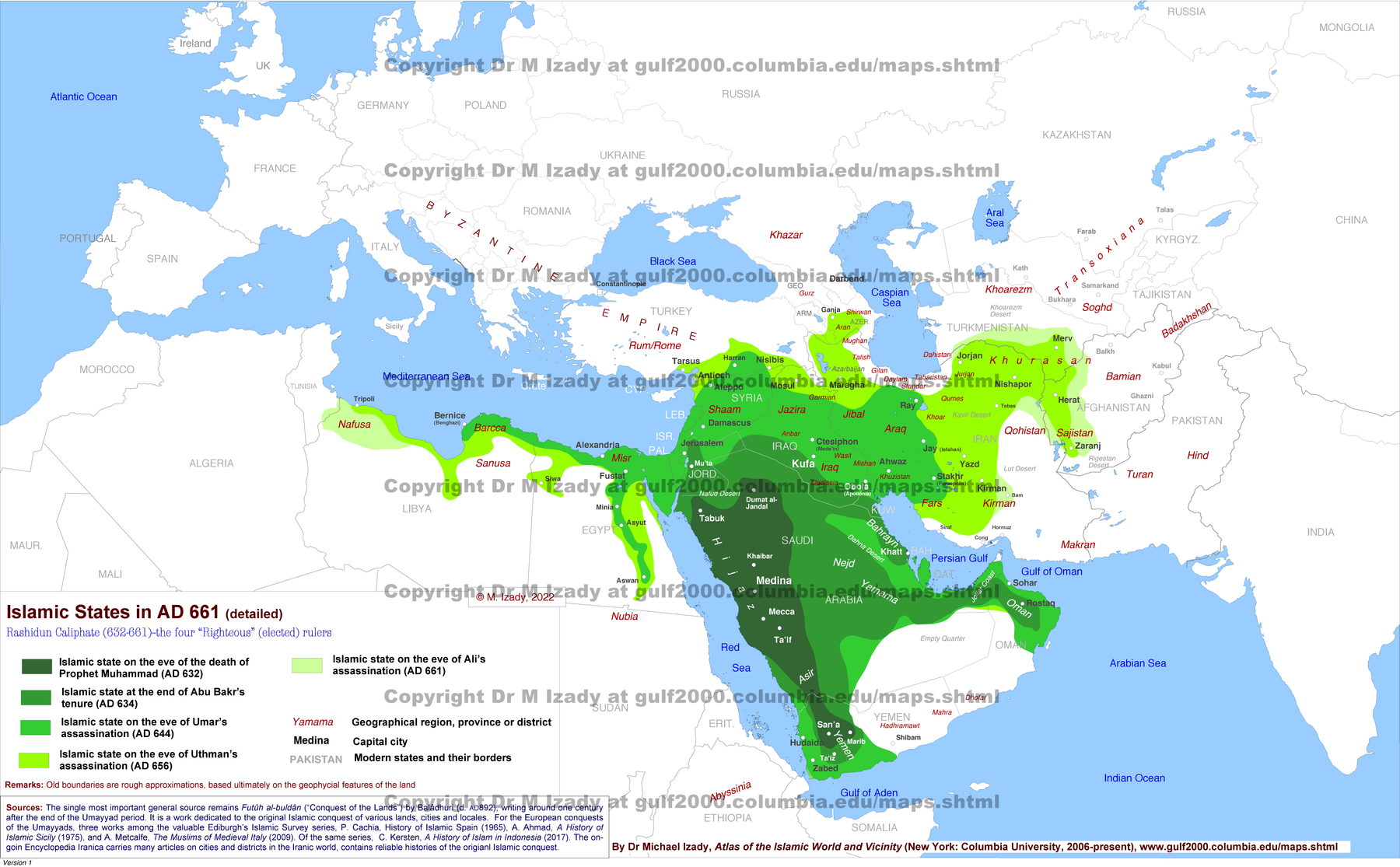
- Islamic States in AD 661 (detailed) · Saved original.
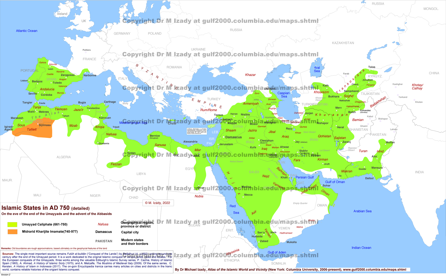
- Islamic States in AD 750 (detailed) · Saved original.
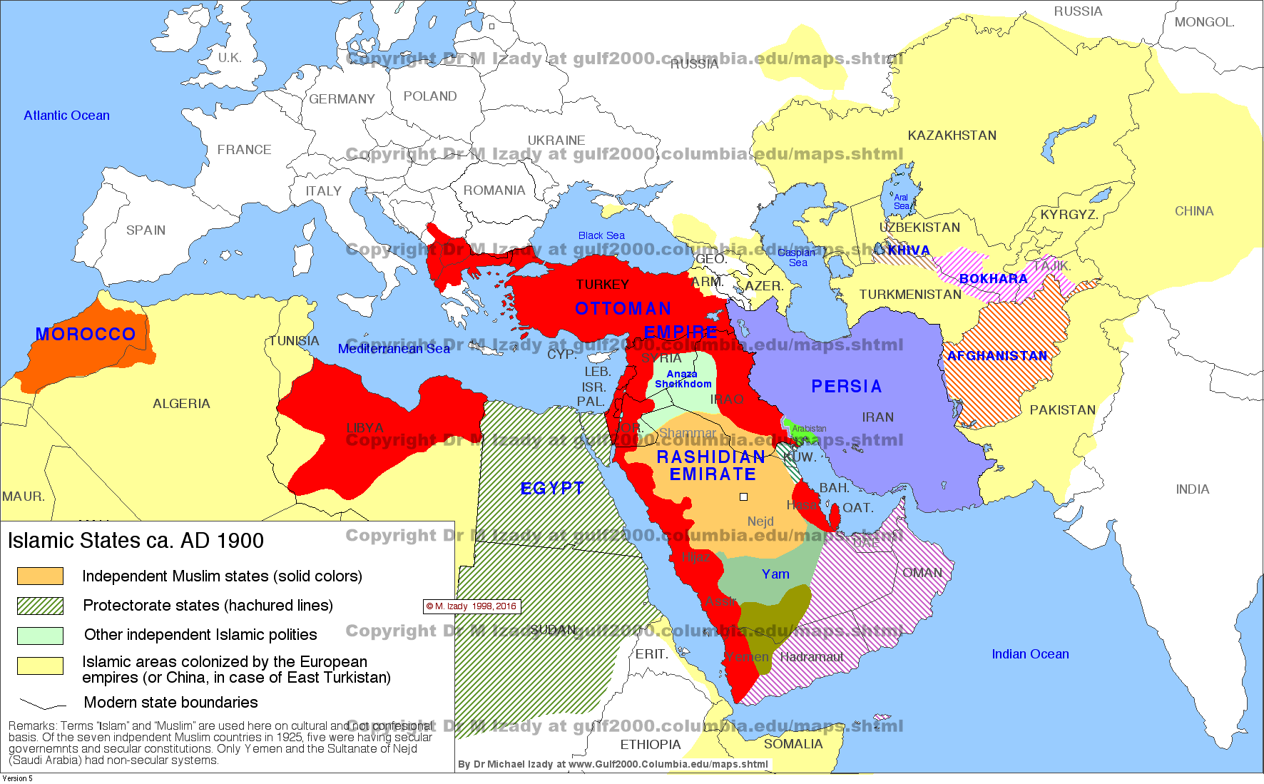
- Islamic States ca. AD 1900 (summary) · Saved original.
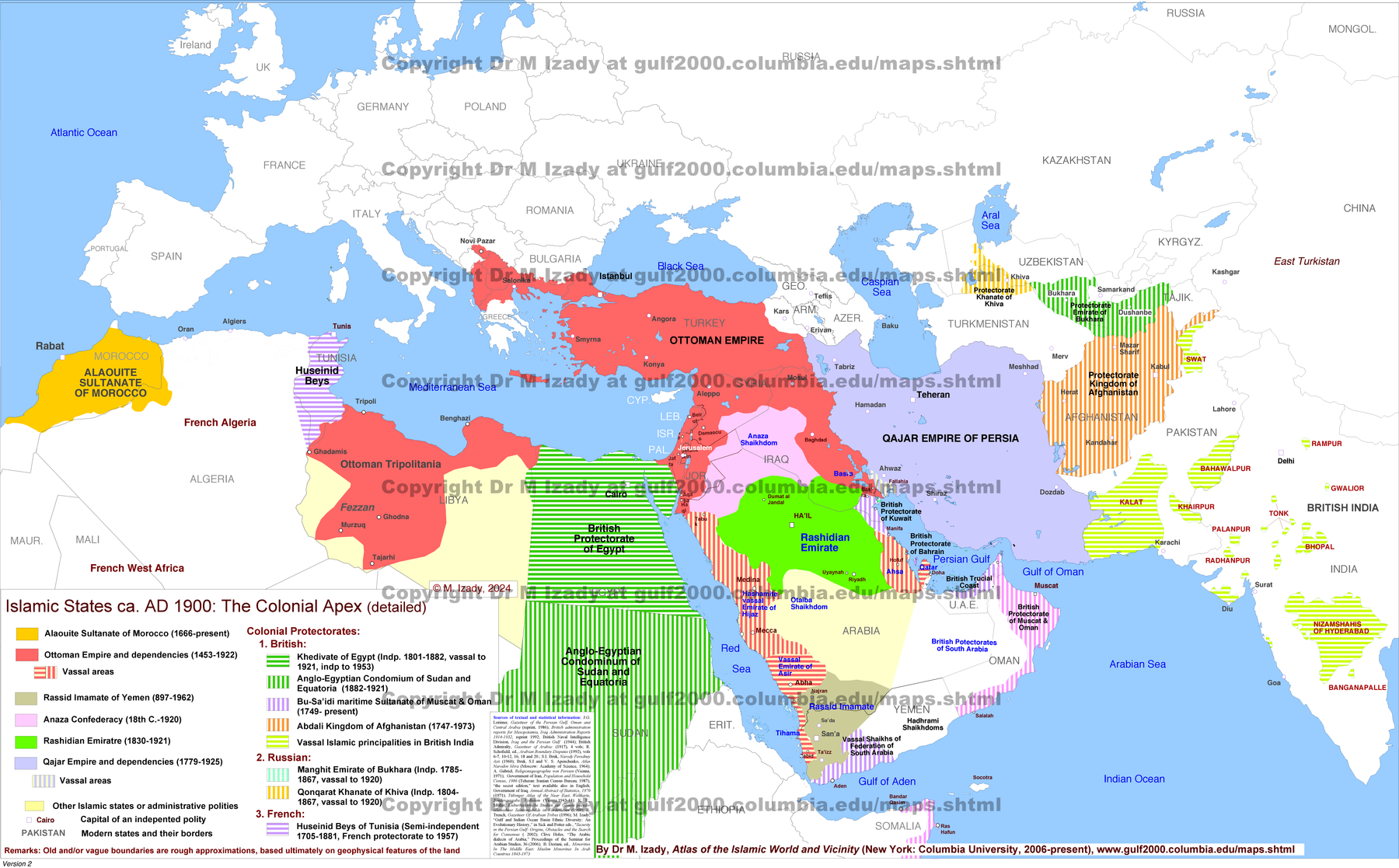
- Islamic States in ca. AD 1900: The Colonial Apex (detailed) · Saved original.
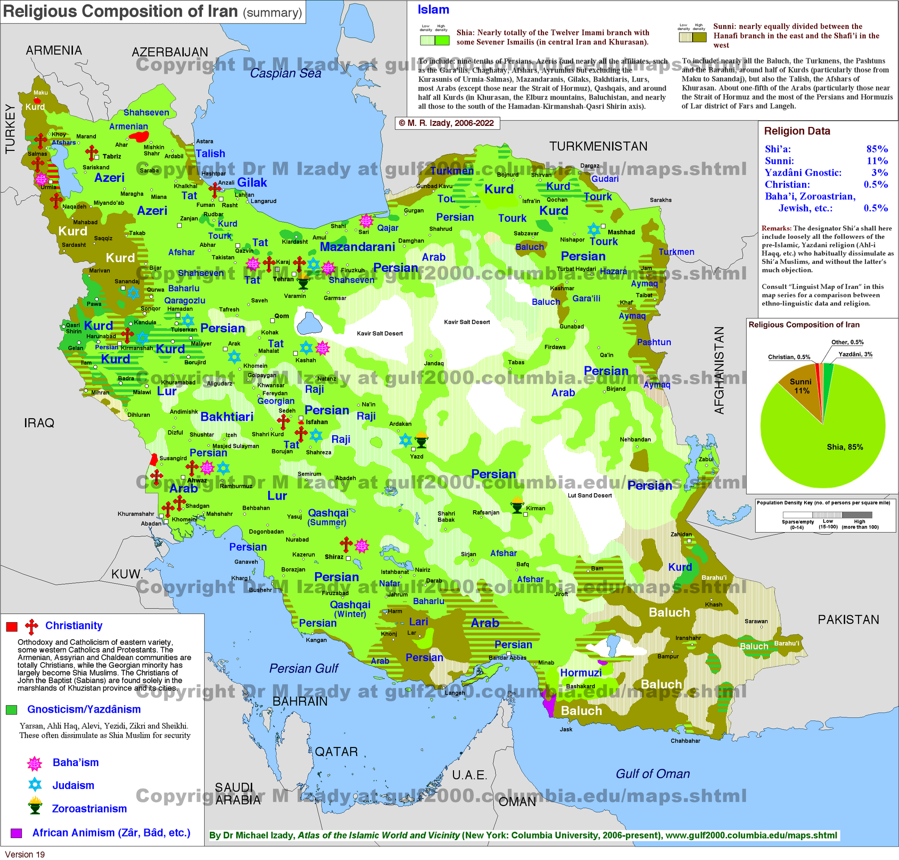
- Iran Religions (summary) · Saved original.
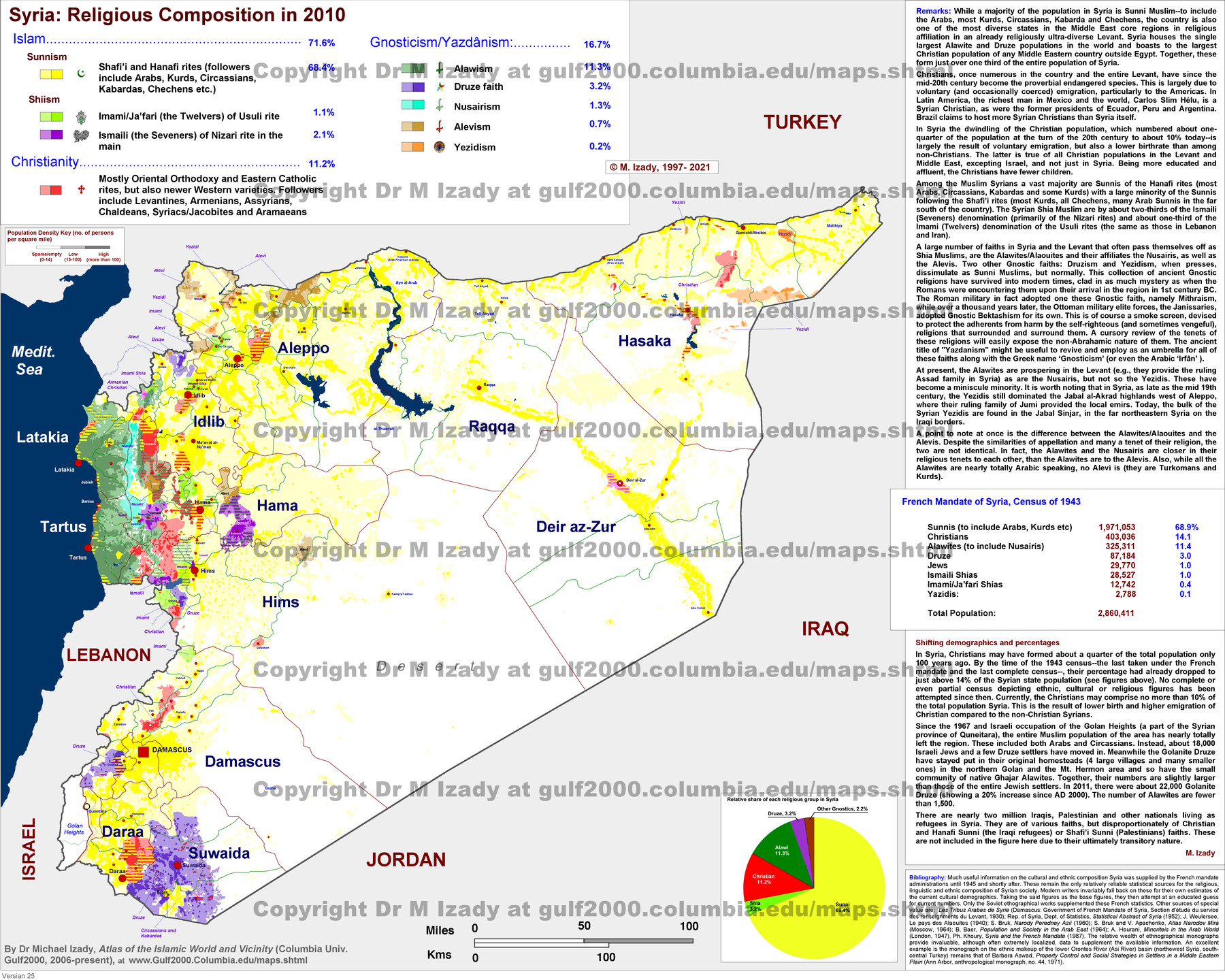
- Syria Religious Composition in 2010 (detailed) · Saved original.
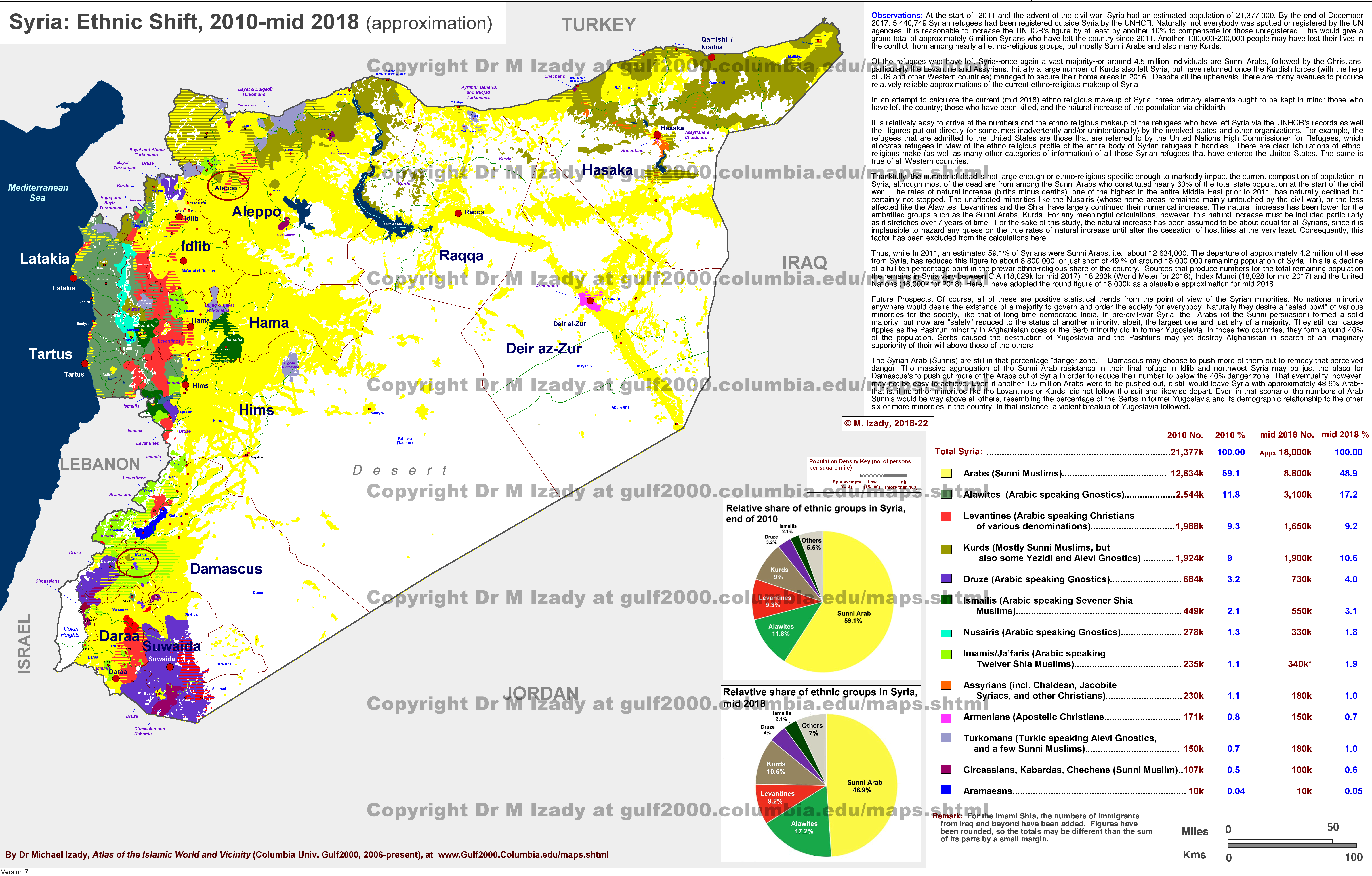
- Syria Ethnic Shift, 2010-2018 · Saved original.